

The Stipertones is a jagged ridge of bare stone tors in the Shropshire hills that come with enough myth and legend to keep any walker happy. I’m told it’s where Shropshire witches meet to sup with the devil as he sits on the rock called the Devil’s chair… which sounds like an amazing story! After hiking in the area I can certainly see where the mystery and legend came from, the gnarly rocky outcrops and fast moving weather provided lots of interest.


The Urban Wanderer and I did a simple-to-navigate circular hike from Nipstone Camping a little south-west of Shrewsbury and very close to the The Bog Visitor Centre, having been recommended the area by a couple of friends. We’d explored Shrewsbury on foot the previous day in the hot sunshine of the 2018 summer, camped overnight at the basic but absolutely lovely campsite, and headed out after breaking camp and feeding the pigs for what promised to be an excellent walk in the hills. It was warm – very warm – but the forecast was quite certain the weather would break before we made it back to the cars, so we were prepared to get a little damp.


Our six-and-a-bit-mile route started by taking us a little south through some woodland and across some meadow, but before long we had crossed the country lane and were heading up onto the hill around The Rock and then north towards Nipstone Rock. It was here I took a small detour across the heath to collect a discarded helium balloon – honestly people, don’t let these things go, and please take your litter home.


We crossed farmland and meadow, detouring slightly around a beautifully landscaped farmhouse to get a view down the other side of the hills, before dipping down into a slight valley and back up the other side towards the Stipertones proper. We used an accessible footpath with views to the west before heading up and over the heathland towards the rocky outcrops that make this area famous.

The colours up here were simply stunning. Even though there had been significant drought for weeks in the area, there was some red and purple hanging on, and it made for the most gorgeous scene. Sarah and I took so many photos, we needed to preserve this scene for it was incredibly beautiful. The whole area here is designated as Stiperstones National Reserve, and quite rightly so, long may land like this continue to be protected.

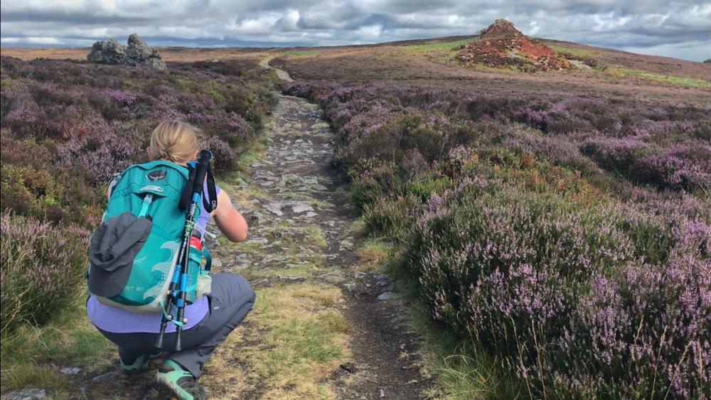
Once on the east side of the Stiperstones we passed Shepherds Rock, Devil’s Chair, Manstone Rock and Cranberry Rock. I’m told that the area was formed of quartzite rock in the last Ice Age, when the hills here stood above the glaciers and were subject to the full force of the weather. The rocky tors took our attention from the moment we saw them, they draw you in, dominating the skyline and begging you to climb up on top. The views to the east from them were stunning – as long as they lasted – and I can definitely see why this area is popular.


The trig pillar, because there has to be a trig pillar when you’re heading out for a day hike, was the most precariously placed trig I have ever seen. Planted right on the top of one of the rocky outcrops – Manstone Rock, I put down my pack and scrambled my way up as the fog came in, determined to bag it before the wind picked up too much and the rocks were too slippery with the rain. I made it up, but it was just too windy to stand on top as is my custom, so I guess I’ll have to return on a milder day for another go at this one. (Go on, tell me about a more difficult-to-reach trig, I’d love to know!)


From here it was predominantly downhill along the Shropshire Way, following the easy to navigate footpath down off the hills and away from the cool rock formations.

As anticipated, we were not particularly fortunate with the weather. The forecasters were bang on, and the sky did indeed leak a considerable amount during our hike. We were more than happy with that, though; we’d been so hot and sticky the previous day and we really did need the rain. There had been a small wildfire just down the road a week or two previous, and the heather and fern on the hills was looking so brown and parched. It was a little changeable to say the least – bright sunshine, pouring it down, bright sunshine again, misty with low cloud, and pouring it down again. Once up on the hills we could see the weather front moving in fast – we were well warned. By the time we reached The Bog Visitor Centre towards the end of the hike, we were soaked through to our knickers, and while we had a bit of a gander at the displays in the entrance, we chose not to stay for tea and cake and headed along the track and back to the cars to change. It’s funny, sometimes terrible weather can completely ruin a day hike, but not today, we continued to chat and laugh our way along the trails even when the rain was at its heaviest. We were prepared for it, dressed for it, and quite enjoyed the feeling of hiking in the rain on this occasion.


We made use of parts of the Nipstone Wanderer trail and the Shropshire Way throughout the day – there are so many hikes around this area ours really was only a toe-dip into the Shropshire Hills. I’ve had the pleasure of hiking the Long Mynd before, and I would also highly recommend that as a great place to explore on foot. I definitely think Sarah and I should meetup again this summer and do another Shropshire hike; where in the area would you recommend?


If you want to do the exact hike we did, I’ve saved it as a route over on the OS Maps app. You’ll need to be subscribed to use it; you can sign up for a seven day free trial or buy a subscription here.
And if you’re curious about the things I carry when I go on a day hike, this post should help.

Do you like day hike write ups like this, where I share more about my experience of hiking a particular route? Would love to know.