

There are lots (and lots) of walking options on and around Cleeve Hill on the edge of the Cotswolds, it’s a very good place for a wander and is very popular for good reason. Some people will do the same two mile loop each time they visit, nothing wrong with that, while others will head off in all directions to find new paths to explore.
In this post, I want to share one of my favourite walking loops across this stunning hill.


This is a six-mile easy to navigate circular walk on well-defined footpaths. It’s not flat; there is a steep descent and some undulating ground, but it’s not a difficult walk and should be doable by most in two or two-and-a-half hours. There is free parking available (described below), and there are some facilities in the Golf Club which is now open to the public.

Location and Route Finding
This six-mile circular route starts and finishes on Cleeve Hill. Of course, being a circular route, you can start and finish anywhere you choose along the path, but by far the most convenient is the golf-course end of Cleeve Common where there is parking available and now a coffee shop open to the public.
The Quarry car park, which is right at the end of the short single lane road to the Golf Club over the cattle grid (grid reference SO989272, or use the nearest postcode GL52 3PW), is popular and often busy. It’s very convenient and open all day (8am to 8pm at the time of writing).
You’ll also find parking in a couple of laybys on the B4632 close to Stockwell Lane (marked as a viewpoint on the OS Map); please remember to park completely off the road and with respect for those who live along this stretch of road.
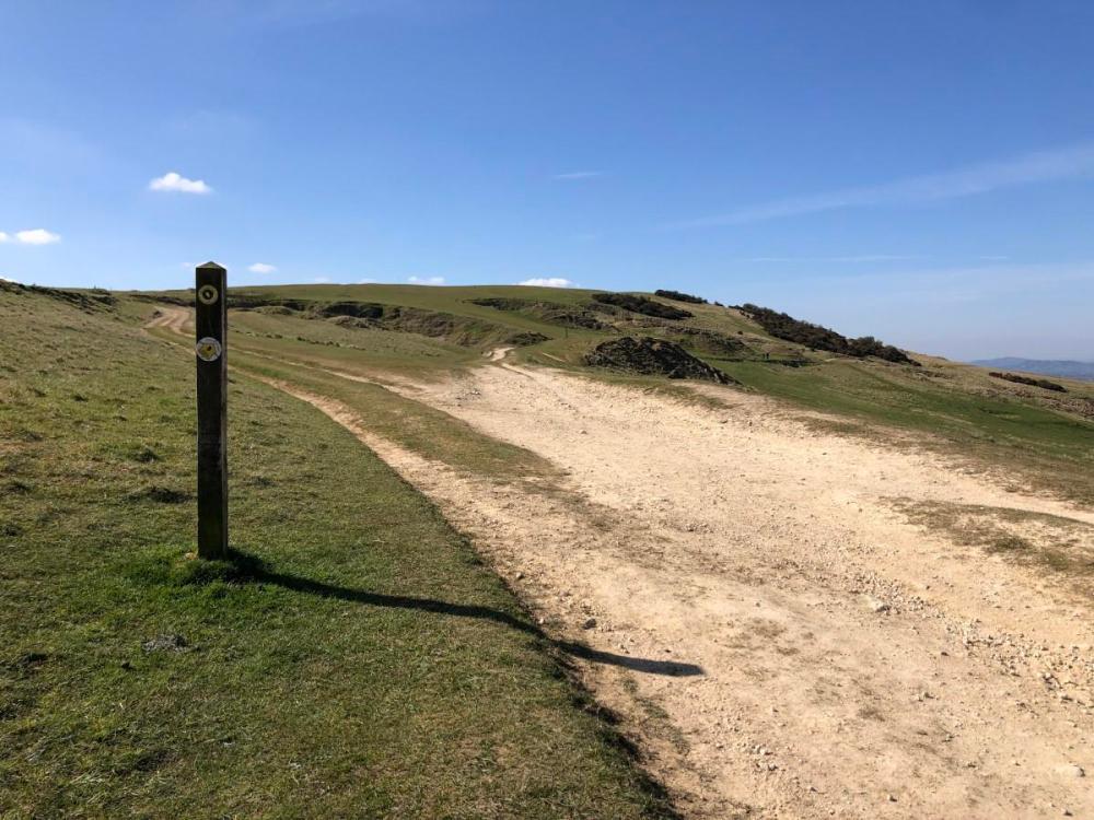
All the paths in this walk are very well defined, making walking reasonably easy going, and all are part of well signposted routes including the Cotswold Way and the Winchcombe Way. However, please note that due to a small number of stiles and a couple of kissing gates, this is not a fully accessible route for all.
I plotted the route over on OS Maps here for you to download, print and follow. If you have never tried OS Maps and want to, start here (affiliate link, thank you for supporting my hobbies).


If you’re using a paper map you’ll need both OL45 and 179 (Cleeve Hill sits on one, Breakheart Plantation on the other; we really need an overlap for the Cotswolds). This is the very reason I prefer to print my route maps from OS Maps instead, as then I only need one sheet of paper instead of two bulky maps.
Anyway, to the walk. I’m assuming you are starting in the Quarry car park as mentioned above.
The Two Trig Pillars of Cleeve Hill
In my opinion, this walk takes in the best bits of Cleeve Hill, the highest point in the Cotswolds, with the added benefit of also going through the beautiful steep sided woodland of Breakheart Plantation. Making use of the Cotswold Way and Winchcombe Way, taking in two trig pillars, there’s some amazing views (into Wales on a good day) and plenty of historical interest.
From the Quarry car park, follow the Cotswold Way along the edge of the Scarp, around the side of the hill, and then up to the trig pillar. The views from here are spectacular, especially if you luck out with a non-hazy day. And while you’ll feel on top of the world here, this isn’t the highest point in the Cotswolds, that’s nearly a mile further on.

Continue following the Cotswold Way waymarkers until it goes through a gate and heads down the hill. The views over the valley continue all the way along, if you’re anything like me you’ll take many photos on this stretch of the walk. Don’t go through the gate, instead continue along the fence line, passed the radio masts (and another small car park), up to the second trig pillar of this walk – and the real high point of the Cotswolds. Of course, the view from here isn’t quite as stunning as the other end of Cleeve Common, but it’s still worth ticking off.

From that second trig pillar, head East across the common land, which while not a marked footpath on the OS Map is well trodden and reasonably obvious when you’re stood with your back to the post. It’s not long until you meet the Winchcombe Way where it goes through a gate and between fields, which this route follows down to Wontley Farm and its ruined barn.

Turn left at crossroads at the barn, staying on the Winchcombe Way. If you keep going along this path you end up at Belas Knap and then Winchcombe, which is well worth it another time, but this route is all about the woodland, and so we turn left onto the Cotswold Way which is very clearly signposted.
Breakheart Plantation
I wanted woodland, I love woodland, and so Breakheart Plantation is the whole point of this walk for me.
Being a plantation, there is always a chance there will be no trees at this moment in time, as by their nature they are tree farms. But I was full of joy to not only find it was dense woodland, but that the woodland was wonderful. Thick green forest floor, the sounds and smells of nature, and not another human soul for the whole time I was there. I wonder if the very steep hill puts some people off, or if I’ve always picked very quiet days to walk there, but I rather enjoy the woodland stroll on my own.

I’ve been trying to find some history of Breakheart Plantation but so far haven’t been able to find any. It would be cool to learn something of when this plot was first planted and by whom, but for now I’ll just have to make the most of its lush green shade and sounds of wildlife.
The route is very straightforward as it follows the Cotswold Way from now until the end of the loop, so you can really enjoy the scenery and not worry too much about the navigation. Once in the thick of the plantation, the footpath heads very steeply down into the valley, before following the contour line just a little higher than a stream. The sights, smells and sounds in this woodland are just stunning, I love wandering along the Cotswold Way here, nice and slowly, feeding my soul with the fresh green surroundings.


Postlip Hall
At the end of the plantation the Cotswold Way heads over a footbridge, and up through a field (which was full of very inquisitive lambs the last time I walked this route) towards Postlip Hall.

Postlip Hall is a Jacobean Mansion surrounded by 15-acres of gardens and farmland. It is home to an established co-housing community of eight families they describe as a “village under one roof”. It’s beautiful, very majestic looking on the side of the hill. Sometimes I wish I lived in a house like that, with all that space and grandness, but I’m sure it’s very expensive to heat in the winter…
There’s also a medieval tithe barn, a well, and a Norman chapel (St James’), all marked on the OS Map, which add to the charm of this part of the route.

Go through the farmyard and a couple of gates and you are back on Cleeve Common again, still on the Cotswold Way. It’s not too bad a climb back up the chalky footpath to join up the loop and finish the walk.


And there we have it. A beautiful and varied six-mile walk taking in the highest point in the Cotswolds and some stunning woodland, my favourite route on Cleeve Common at the moment. I think the key thing about this route for me was how far I felt far from civilisation at times. Cleeve Hill itself can be quite busy, but there’s so much space you really don’t need to go far to escape other people and find some solace.
Let me know if you try out this route, or if you have your own favourite routes in the Cleeve Common area that you think I should try out the next time I head up the hill.
If you want more short loops in the Cotswolds, check out some of my other hiking posts such as this one featuring six short walks in the Cotswolds, and this one with four hills to climb near Cheltenham. Alternatively, use the route-finding function over on OS Maps to discover both published routes and routes that others have plotted to give you some ideas.
If you have never tried OS Maps and want to, start here (affiliate link, thank you for supporting my hobbies).