If this is the first of my UK Coast to Coast Adventure Journal posts you are reading, please do consider going back to the beginning for the full story.
After a number of short days in terms of distance hiked, day 12 of our UK coast to coast hiking adventure would be a bit of a shock to the system. With 20 miles to hike from Osmotherley to Blakey Ridge, including five not insignificant climbs and some very exposed moorland walking, we were in for quite a day.

I can tell you right at the start of this adventure journal that it was a good day. I was tired and slow, as I had been for the previous 150 miles, my legs hurt, and I struggled with the constant need to will my body to keep going in the last few miles of the day. On the converse, we had bluebird skies, clear views, amazing scenery, good food, familiar ground, and there was never any chance we weren’t going to make it.
The Lyke Wake Walk
We were no stranger to this section of the walk. Back in 2015 Jenni and I hiked the Lyke Wake Walk with another friend, Allysse. We did the 40-ish mile linear walk from Osmotherley to Ravenscar across the North York Moors in two days.

The Lyke Wake Walk is pretty much a straight line between the two villages at either end of the Moors, and includes all kinds of terrain. The trek goes over several peaks, across moorland, through marshland (and I mean “through”!), along tracks and rural roads, and across streams and rivers (with and without bridges).
It’s a great hike and one I’d recommend to anyone wanting a short but sharp hiking challenge for the bucket list. There’s also a 24-hour challenge associated with the hike, if you really want something tough to try.
I’ve often referred to the Lyke Wake Walk as my first long distance hike, as while I’d done big hikes before that, this was the one that opened up the idea of multi day hiking to me. I wrote at the time how it was way out of the comfort zone of this busy full-time-jobbed hobby-blogging gal who is very good at finding excuses not to exercise, but that I was proud that I was able to do it. Sound familiar?!

The Right Attitude
Day 12 of the coast to coast hike pretty well matches up with the first day of the Lyke Wake Walk. It helped that I have fond memories of that adventure experience. I went into the day in the right frame of mind – I’d walked these 20 miles once before, had built up a lot of hiking experience in the years since then, and knew I could walk them again.
At the same time, I wasn’t being naïve. Despite having a few short days in the lead up to this bigger one, I knew it would be tough. But somehow, I was ready for it.

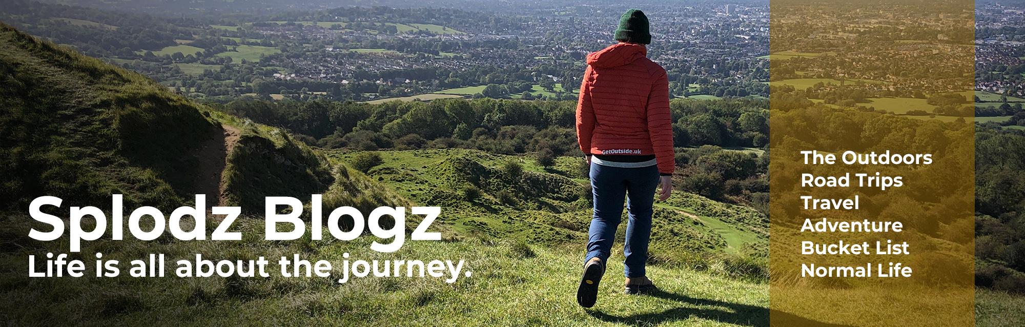
UK COAST TO COAST HIKE ADVENTURE JOURNAL
Day 12 | Thursday 21 October | Osmotherley to Blakey Ridge
It was a cold night at Cote Ghyll in Osmotherley. I mean it was probably a cold night everywhere in the north of England, but I can only speak of the temperature in my tent in this particular spot in Yorkshire. And that was cold.
Not terribly cold, but cold enough to wish I’d got out of my cocoon to put on another layer. Sometimes you have to get colder in order to get warmer, but I am yet to act like I’ve learnt that lesson. I did sleep reasonably well in-between the shivers, thanks to my OEX Fathom EV 300 synthetic sleeping bag, my silk sleeping bag liner (a reasonably priced one from Decathlon), my thermal leggings and long-sleeved top, and a thin fleecy layer I’d packed for relaxing in.
I woke up about five minutes before my alarm would have shouted at me, which I consider a bit of a result. It had rained a bit in the night and the ground around my tent was more than a little bit squelchy, so I did what I could in my tent before decamping to the hard standing by the ablutions block to sort everything else out. A wet tent I can deal with, but a wet and muddy one? No thanks.

Getting Going
We were on our way by 8am, starting with a mile or two up a gradually ascending and ever narrowing lane past Cold Beck Reservoir (which we could just about make out between the trees), giving us our first taste of the moorland scenery we’d see throughout the day. It had clearly rained a lot here over the past few days, with a number of road-wide puddles to wade through – we very much hoped that the ground wouldn’t be too wet once we were up on the tops.
We met up with the start of the Lyke Way Walk, grabbed a photo to send to Allysse, and naturally recounted tales from that past adventure. This is exactly why I go on adventures – so I can reminisce years later, telling stories of the trials and tribulations of pushing my comfort zone just a little bit. This stuff is all about the memories.
As the lane went steeply downhill, we picked up the Cleveland Way, which would be our home for the next 12 miles or so. It would be a particularly easy to navigate day, not only because it was incredibly well waymarked – well done to the people who look after this trail, but also because it was familiar.

The Cleveland Way
I particularly enjoyed the calm and peaceful wander through Clain Wood. Dense with conifer trees, woodland is something we’d only had a very small amount of along the coast to coast route, and I relished every opportunity I had to be amongst the trees. We used a bridge to get over the ford just outside Huthwaite Green, skirted around the contour of the hill to Live Moor Plantation, and then got on the rollercoaster that is the Cleveland hills…
The steps up through the woodland here to Live Moor are a bit of an uneven pain for my clumsy self, but this is such a beautiful path, I could forgive it. The climb made me pant, but as it was just the first of five significant uphill sections we would face early on today, I just had to put my head down and get on with it. And while I was not going at a quick pace, I did feel fitter than I had ten days earlier. I mean, there was no crying, no wanting to run home, and shouting at sheep!
Carlton Moor was our first trig pillar of the day, standing at 408 metres above sea level. It also provided us with our first view of the North Sea, a pretty big moment considering that was where we were aiming for in just a couple of days. That view also meant we were having a fabulously good weather day. It might have been cold enough to mean I needed my beanie hat and puffy coat most of the time, but it was clear enough to see the sea 45 miles away. Wonderful.

Lord Stones
By 11am we were down in the valley again enjoying an excellent brunch at Lordstones Café. We were just about inside breakfast-serving hours, so I chose the poached eggs on toast with a pot of tea, and enjoyed filling up my belly ready for the rest of the days wanderings. Lordstones Café is a bit of a local landmark with its grass-topped roof, there’s also camping here which means those who’d split that long flat section of trail differently to us might choose to have a night at this spot.

We took the time out of our long walking day to visit the Lordstones themselves, something we didn’t do the last time we were here.
The name Lordstones (or Lord Stones as two words, depending on which version of the map you look at), comes from the three Lords that owned estates that met at this point on Carlton Bank. They are typical of boundary stones that are found across the North Yorkshire Moors and beyond. There are prehistoric (Bronze Age) markings on the largest of the stones that suggest this point was marked by these very stones long before the three Lords came along.

Five Steep Climbs
After a break brunching and being outdoor tourists, it was time to get back to our hike. We started with a climb up to Cringle Moor (also known as Cranimoor), a small domed shaped moorland which is topped by the Alec Falconer Memorial Seat.
Founder member of the Middlesborough Rambling Club, Falconer had actively campaigned for the opening of the Cleveland Way. He passed away just one year before the trail officially opened and this seat – which commands stunning views of the landscape around – was erected in his memory by his friends.

The high point of this hill, Drake Howe, is an ancient burial ground, but the path doesn’t take us up to the 432m summit – we didn’t add the extra on but it would make a nice detour another time. Instead, we continued along the path above Kirby Bank before dropping down very quickly on deep stone steps into the valley.
On our way down, we chatted to two guys walking up the path carrying camping gear. They were hiking the coast to coast from east to west, hoping to get over to St Bees before the promised storms of the following couple of weeks hit. It was always good to meet other hikers, and when I was back at work the week after I thought of these two chaps and wondered how they were getting on in the Lake District at the end of their hike.

Big Rewards
Next up, we climbed up to the nail-end of the finger-like hill of Cold Moor, at 402m. A short but steep climb. It’s the kind of hill I don’t mind – a lot of effort in the moment, but it’s over quickly and has fantastic reward at the top.
In fact, even though there are five hills like this quick succession on this section of the coast to coast hike, each becoming harder than the one before thanks to depleted energy reserves, the whole walk is superb. Helped by us hitting the jackpot with the weather, of course.

We descended to Garfit Gap, before enjoying a fun boulder-filled scramble up and over Wain Stones. This rocky outcrop of sandstone is covered in Bronze Age markings, and I’m told the boulders have cool names such as “the sphinx” and “the steeple and the needle”.
We almost certainly didn’t take the most direct route around the stones here, but you might say we made the most of an opportunity to clamber over rocks and enjoy the different viewpoints from the tor-like hilltop. Re-reading the guidebook as I write this adventure journal, I notice the following line: “it’s safer to walk through, rather than around, the stones”. Ah. Oops. We were fine.

We bounded along Hasty Bank, which was a little boggy in places, before making another very steep descent to Clay Bank Top. By this time my knees were quite unhappy, and I was definitely relying on my walking poles to stop the legs shaking too much on the downhills. But with just one big climb left and then miles (and miles) of rolling moorland, it was simply a case of marching through the wobbles and taking regular breaks mid-hill to let the burning stop!

Bleak and Barren
Our final steep climb of this five-hill section of trail was a slabbed path with steps up to Carr Ridge. It’s here the paving slabs ended and were replaced by a more standard grit path, which also levelled out into a gradient my legs were much happier with.
The highest point of day 12 was the trig pillar on Urra Moor, standing at 445 metres above sea level. Although the trig takes second place to the two boundary markers along the path, the first having a hand carved on it, and the second a face.

It is at this point that the rugged nature of the moors really opens up, and you can see the bleak and barren landscape you’ve wandered into. With around eight miles still to go, the path stretches out ahead, with what seems like no features to break up the endless scene.
Like our day walking across Rannoch Moor on the West Highland Way, this filled me with a real inner peace and joy – I was walking, under my own steam across what felt like an incredibly rural and rugged landscape. And despite it being a challenge, I was loving it.

Disused Railway
Leaving the Cleveland Way at Bloworth Crossing, we joined the disused track of the Rosedale Ironstone Railway (built to carry iron ore from Rosedale), which took us over Farndale Moor and onto High Blakey Moor. Covered in gravel, and raised on levees where the moorland is particularly boggy, it is a very easy to follow path.
Apart from a fleeting sight of a snow bunting in one of the ditches next to the path, the last few miles were void of interesting features. That’s not to say it wasn’t interesting, but this was truly a vast open wilderness through which we walked, with little to write about.
I found our pace that afternoon very fast, and needed two or three short sit-down breaks to let my body catch up with what I was asking of it. I’ll be honest and say that my feet hurt for the last three or four miles of the day. That old railway line is made of very hard stuff, and the constant pounding took its toll.
My Meindl Bhutan boots were absolutely fantastic for the vast majority of the terrain we experienced on the coast to coast route. I trusted them completely, and was grateful for the structure, support, warmth, and waterproofing. But here I really could have done with something a little lighter and softer underfoot. I was very pleased indeed when the Lion Inn came into view.

The Lion Inn at Blakey Ridge
We arrived at the Lion Inn at Blakey Ridge at around 4.30pm, having walked 20 miles and ascended over 1,100 metres (3550 feet). I would say that 8.5 hours to do all that, including a long brunch at Lordstones Café, an explore of the boundary stones, plenty of photo stops (so many photos!), and a few sit-down breaks for snacks, is not half bad.
A well-known landmark on the coast to coast hike, the Lion Inn sits on the Blakey Ridge Road in Kirkbymoorside. It’s something of a rite of passage to overnight here when walking the width of the country, and it was one of our must-dos for this adventure experience. A coast to coast bucket list item, if you will.
As it came into view a mile or more before we reached it, the white rendered inn with orange roof tiles really did appear like an oasis in the rugged landscape. We were fortunate to have good weather, but I imagine it’s even more welcome when it’s wet and windy. I can see why there are tales of ghost encounters here!

The Smallest Room
We’d booked the smallest room available, a little twin-bedded room with a private bathroom across the landing, costing us a very reasonable £55 for the night for the both of us. Given the room was tiny (although still with some storage, two comfortable beds, and tea making facilities), we left some of our things on the landing to give us a little extra wiggle room. Oh, and the bathroom – had an actual bath – I was so glad we had time to make use of that before dinner. Oh, the luxury.
Once suitably relaxed, we whiled away the evening downstairs in one of the inn’s dining room. The food was so good, and while it was very busy, we enjoyed our time there. I chose the mince beef and dumplings, followed by jam roly-poly – it was proper home cooked unfussy food, which was every bit as warming and comforting as I wanted it to be.
A bath and that meal was exactly what I needed to recover from the day’s exploits.

Reflections on Coast to Coast Day 12
Despite being a long and tough day, our 12th consecutive day walking the UK coast to coast was glorious. While I can’t overlook how sore my feet were when we reached the Lion Inn at Blakey Ridge, and how much I struggled to get up those five big hills without making ridiculous panting noises, or even how I failed to keep up with the pace Jenni was able to manage, I look back on this particular Thursday with huge fondness.
It was one of those days where the struggles felt in the moment have faded into insignificance, leaving me with a lasting memory of happy hiking.

We had perfect October hiking weather with a cold but bright blue sky, which provided big views, including our first glimpse of the North Sea, and allowed us to enjoy the vast landscape of the North York Moors in its finest autumnal colours. The rain of the previous few days didn’t matter anymore –sunshine really does make a massive difference in life.
Navigation was super simple, which also helped. This was thanks to a combination of it being incredibly well waymarked, and the fact we’d walked it before. Add to that the footpaths are very well maintained in this area, and we had plenty of confidence to just get on and walk. This really is exactly what you need when there are 20 miles between breakfast and dinner.
But the best bit of the day? The scenery was nothing short of superb. It was everything I like about hiking in England – hills with views all around, ancient history to see and explore, rocky outcrops with “climb me” written all over them, and vast rugged landscapes with apparently nothing of note. The rest of the hike had a lot to live up to.


What do you think? Comment below...